

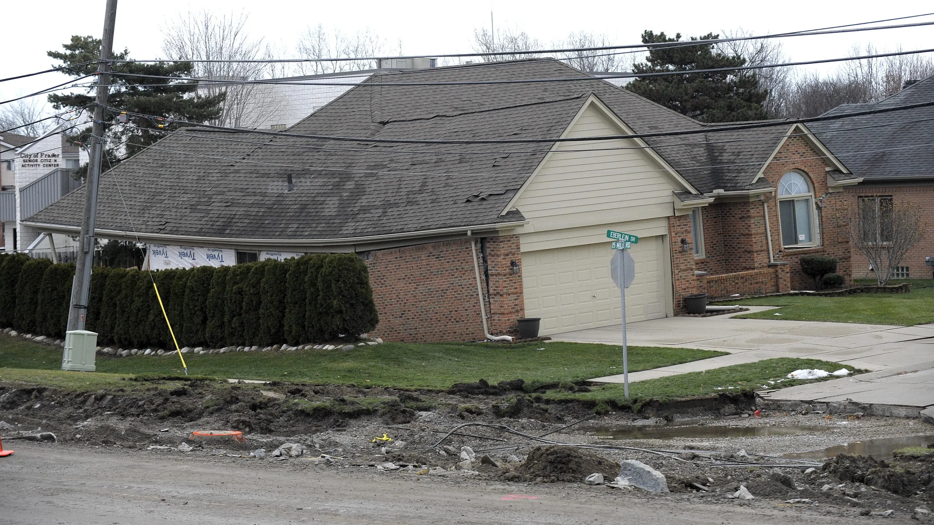
It was Christmas Eve, 2016, and Zachary Carr with FK Engineering was enjoying the first day of his holiday break when his phone rang. It was his boss, with bad news: a huge sewer line had collapsed under a suburban Detroit neighborhood, causing a sinkhole the size of a football field. Houses were being engulfed, and the neighborhood was being evacuated. “We’ve got a big problem,” he said.

This interceptor system had a history of sinkholes - three others had occurred since the line was constructed in the 1970’s. This latest sinkhole, which ended up destroying three homes and forcing the evacuation of 22 more, launched a critical infrastructure rehabilitation project to prevent disasters like this from ever happening again. Involving 29 miles of interceptor lines supporting over 800,000 people, this multi-year, $70 million project required the construction of the “Segment 5” pump station with a massive earth retention system and a 65-foot deep shaft to expose the aging interceptor and effect repairs. In addition to having to work under several major power lines - the site was right on the ITC corridor - soil conditions were challenging: sand, silt, and a high water table required continual de-watering during excavation and construction of the shaft, making 24/7 remote water-level monitoring critical to the project.
Inzwa Cloud & GeoNet provide continual visibility of the project’s remote sensor data
Carr placed ten GEOKON GeoNet vibrating wire piezometers on the site to provide continual remote water-level monitoring. In addition to the original third-party environmental monitoring software, he also opted to add the Inzwa Cloud environmental monitoring system as a backup, given the platform’s ability to log, visualize and report data from third-party devices like the GeoNet data loggers. “We needed to make sure that if there were problems on the weekends... that we’re alerted right away with their emergency alerts,” Carr explained.
“Is the whole remote sensor data monitoring
system down?”

“So, of course, it was a Saturday morning when the [original] remote system went down,” Carr continued. “It was all hands on deck... we were all kind of panicking, and then it hit me, let’s check the Inzwa platform as well… I was able to still see our data, which was a complete and utter relief to me,” he said. With the Inzwa Cloud’s integration with the GeoNet data loggers, Carr was able to confirm that the devices were operational, the remote sensor data was still reporting, and that no crisis was developing. "With the criticality of monitoring water levels 24/7, Inzwa saved my bacon and reduced my stress level that weekend,” he concluded.
Inzwa Cloud Environmental Monitoring Software Integrates with Third-party Devices
The Inzwa Cloud environmental monitoring system is a "plug & play" remote sensor data management platform that integrates seamlessly with a broad array of third-party geotechnical monitoring sensors from leading manufacturers, including:

Vibration
Tilt
Sound
Dust
Vibrating wire
Total Station
Piezometers
Inclinometers
Extensometers
Crack gauges
Load sensors
And more
Don't see yours listed? Contact us and we will be happy to work with you to add it to the platform.
Want to hear more?
To view the webinar in full, please click the image.